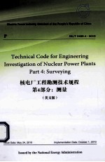

DL/T5409.4-2010核电厂工程勘测技术规程 第4部分 测量 英文PDF电子书下载
- 电子书积分:10 积分如何计算积分?
- 作 者:国家能源局发布
- 出 版 社:北京:中国电力出版社
- 出版年份:2013
- ISBN:7512341050
- 页数:205 页
1 Scope 1
2 Normative References 2
3 General Provisions 4
4 Horizontal Control Survey 7
4.1 General Requirements 7
4.2 Satellite Positioning Survey 9
4.3 Traverse Survey 16
4.4 Triangulation Surveys 30
5 Vertical Control Survey 37
5.1 General Requirements 37
5.2 Leveling 38
5.3 Trigonometric Leveling 46
5.4 GPS Elevation Survey 52
6 Topographic Survey 55
6.1 General Requirements 55
6.2 Mapping Control Survey 58
6.3 Surveying and Mapping Method 64
6.4 Ground Feature Surveying and Mapping 70
6.5 Surveying and Mapping of Landform 75
6.6 Underwater Topography Surveying 77
6.7 Marine Surveying and Mapping 84
7 Digital Photogrammetry 90
7.1 General Requirements 90
7.2 Technical Requirements for Aerial Photography 92
7.3 Acceptance of Aerial Photography Data 94
7.4 Photo Control Survey 95
7.5 Photograph Annotation 102
7.6 Digital Mapping 103
7.7 Digital Image Product 110
8 Application of Satellite Remote Sensing Technique 112
8.1 General Requirements 112
8.2 Date Preprocessing 112
8.3 Geometric Correction of Image 113
8.4 Image and Map Decoration 114
9 Construction Survey 115
9.1 General Requirements 115
9.2 Secondary Network Surveying 118
9.3 Building Micro-grid Control Network Surveying 128
9.4 Building Micro-grid Control Network Transferring Surveys 138
9.5 Construction Setting-out and Testing 140
9.6 Deformation Monitoring 152
9.7 Data Processing and Result Submission 157
10 Other Surveys 163
10.1 General Requirements 163
10.2 Surveys for Locating Exploration Points and Lines 163
10.3 Hydrological Survey 166
10.4 Pipeline Surveying 170
Appendix A(Normative) Correlating Different Coordinate Systems 179
Appendix B(Normative) Specifications for Burying Markers and Monuments at Horizontal Control Points 182
Appendix C(Informative) Description of GPS Control Point 184
Appendix D(Informative) Recording Format of GPS Surveying Notebook 185
Appendix E(Normative) Classification and Basic Technical Parameters of Theodolite Series 186
Appendix F(Normative) Formula for Calculating the Initial Readings of Circle and Micrometer in Horizontal Angle Measurement Using Direction Observation Method 188
Appendix G(Informative) Calculation of Basic Parameters and Curvature Radiuses of Earth Ellipsoids of Geodetic Coordinate Systems 191
Appendix H(Informative) Transformation between Zero Points of the Major Elevation Reference Systems in China 193
Appendix J(Informative) Classification and Basic Technical Parameters of Leveling Instrument Series 195
Appendix K(Normative) Types and Specifications of Markers and Monuments of Elevation Control Points of Various Accuracy Levels 197
Appendix L(Normative) Division and Numbering of Map Sheets 200
Appendix M(Normative) Specifications and Requirements for Constructing Control Points of Secondary Network,Micro-grid Control Network and Intervisibility Holes 202
- 《电子测量与仪器》人力资源和社会保障部教材办公室组织编写 2009
- 《互换性与测量技术》王宏宇主编 2019
- 《细菌蛋白分泌系统研究方法与操作规程》(法)劳雷·詹来特,埃里克·卡斯卡莱斯编者;褚怡,崔改泵责编郑福英,宫晓炜,陈启伟,刘永生译者 2019
- 《灰姑娘的难题 测量》(韩)李孝真文 2016
- 《公差配合与测量技术》荀占超 2018
- 《测绘地理信息行业职业技能培训教材 测量基础》自然资源部职业技能鉴定指导中心 2019
- 《电工仪表与测量》殷兴光,王月爱主编 2017
- 《电化学测量》胡会利,李宁编著 2019
- 《心理测量》黎光明编著 2019
- 《测量系统不确定度评定及其应用》王中宇,陈晓怀,吕京著 2019
- 《2013数学奥林匹克试题集锦 走向IMO》2013年IMO中国国家集训队教练组编 2013
- 《2019国家医师资格考试用书 中医执业助理医师资格考试全真模拟试卷与解析 第3版》国家医师资格考试研究组 2019
- 《中药学专业知识 1 国家执业药师考试指南 第7版 2019版》国家药品监督管理局执业药师资格认证中心 2018
- 《2017国家执业药师资格考试 全考点实战通关必备 中药学综合知识与技能 第3版》国家执业药师资格考试命题研究专家组 2017
- 《国家图书馆年鉴 2018》国家图书馆 2018
- 《都匀年鉴》都匀市档案史志局编 2019
- 《药学综合知识与技能 第3版》国家执业药师资格考试研究组编写 2018
- 《管道科学研究论文选集 2009-2013》中国石油天然气管道科学研究院,油气管道输送安全国家工程实验室编 2014
- 《中国关键词 19大篇 汉英对照 2 权威解读当代中国》中国外文出版发行事业局,当代中国与世界研究院,中国翻译研究院著 2018
- 《中华人民共和国药典中成药薄层色谱彩色图集》(中国)国家药典委员会 2019
- 《中国当代乡土小说文库 本乡本土》(中国)刘玉堂 2019
- 《异质性条件下技术创新最优市场结构研究 以中国高技术产业为例》千慧雄 2019
- 《中国铁路人 第三届现实主义网络文学征文大赛一等奖》恒传录著 2019
- 《莼江曲谱 2 中国昆曲博物馆藏稀见昆剧手抄曲谱汇编之一》郭腊梅主编;孙伊婷副主编;孙文明,孙伊婷编委;中国昆曲博物馆编 2018
- 《中国制造业绿色供应链发展研究报告》中国电子信息产业发展研究院 2019
- 《中国陈设艺术史》赵囡囡著 2019
- 《指向核心素养 北京十一学校名师教学设计 英语 七年级 上 配人教版》周志英总主编 2019
- 《《走近科学》精选丛书 中国UFO悬案调查》郭之文 2019
- 《清至民国中国西北戏剧经典唱段汇辑 第8卷》孔令纪 2018
- 《北京生态环境保护》《北京环境保护丛书》编委会编著 2018
